Environmental monitoring — Cisokan working zone
Everything public is presented per grid cell. A cell is 84.9 ha, the unit the field teams and the five-works plan already use. Observations, evidence and social records stay inside the platform.
Grid explorer — the public unit of this dashboard
Coarse activity view. Cells only: no observation points, no camera-trap stations, no nest locations, no social content.
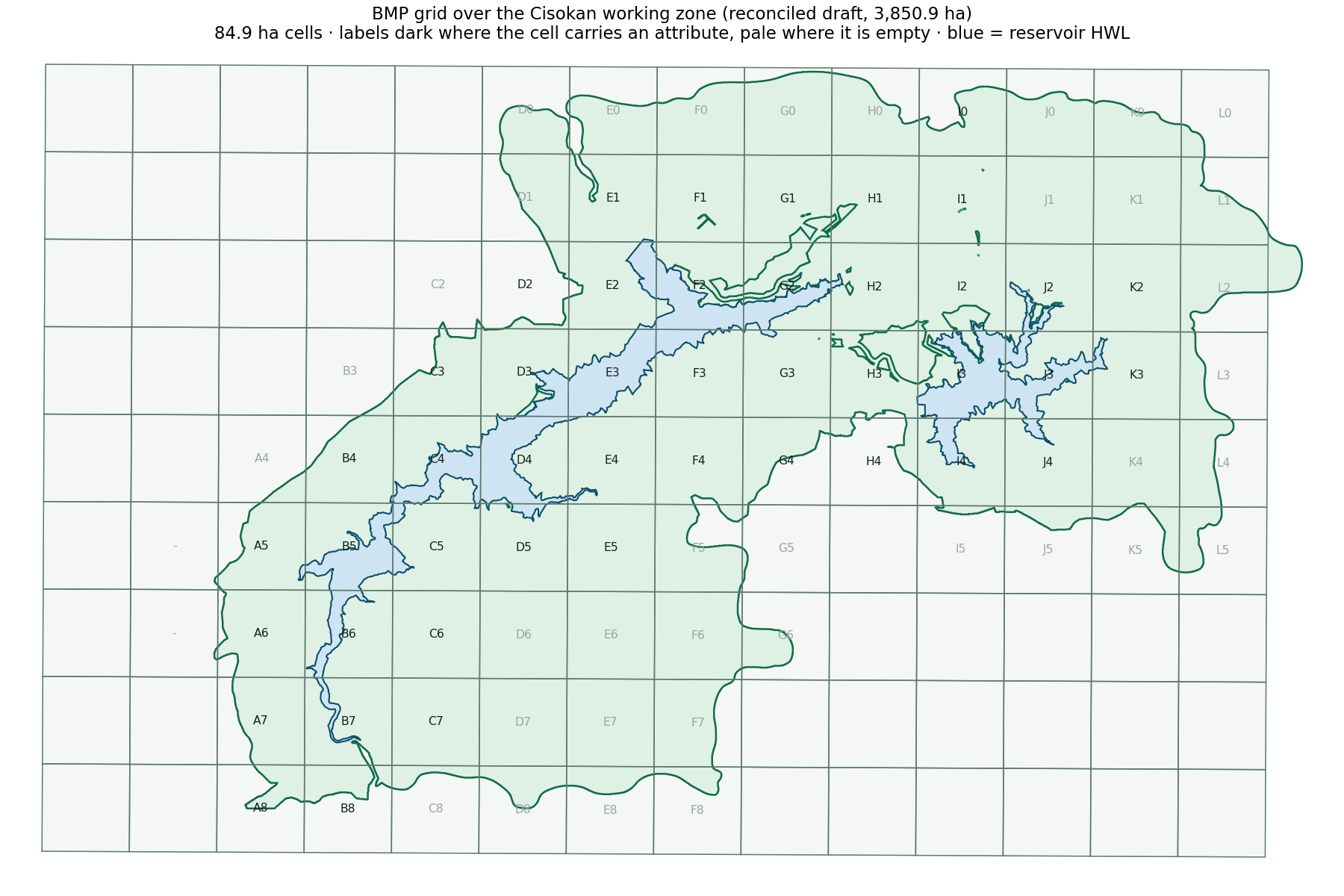
Public cell register (generated from the internal register)
All 83 cells with their public figures: cell_public.csv. Withheld: land-status string, working-zone membership, management model, wildlife species codes, plan-unit identifiers and all social notes.
| Cell | In zone (ha) | Planting planned (ha) | Protect only (ha) | Baseline | Wildlife taxa | Cell page |
|---|---|---|---|---|---|---|
| B7 | 77,7 | 49,3 | 19,0 | yes | 3 | open cell page → |
| G0 | 76,8 | 46,9 | 17,9 | no | 0 | open cell page → |
| A6 | 76,8 | 46,8 | 17,5 | yes | 0 | open cell page → |
| B6 | 65,9 | 44,4 | 15,2 | yes | 0 | open cell page → |
| A5 | 64,6 | 39,7 | 14,7 | yes | 1 | open cell page → |
| E7 | 84,9 | 39,6 | 35,2 | no | 0 | open cell page → |
| F0 | 61,8 | 39,4 | 15,0 | no | 0 | open cell page → |
| A7 | 61,3 | 37,5 | 12,9 | yes | 1 | open cell page → |
| H0 | 58,2 | 36,7 | 13,9 | no | 0 | open cell page → |
| K4 | 84,5 | 36,6 | 36,1 | yes | 0 | open cell page → |
| D3 | 65,9 | 35,6 | 29,3 | yes | 6 | open cell page → |
| D5 | 65,6 | 34,8 | 20,1 | yes | 6 | open cell page → |
| B4 | 70,2 | 32,9 | 32,4 | yes | 1 | open cell page → |
| J4 | 80,9 | 31,4 | 20,6 | yes | 0 | open cell page → |
| E2 | 66,3 | 31,0 | 13,1 | yes | 4 | open cell page → |
Monitoring activity
Verified field records per month. Only verified records are published.
| Month | Records |
|---|---|
| 2026-09 | 3 |
Land cover baseline (real)
PlanetScope 3 m, 7-class map, validated at 93.1 % (Kappa 0.92).
Restoration obligation (real)
Scenario C of the five-works plan, apportioned to cells.
Datasets
Published downloads with the metadata needed to cite them.
How these numbers are made — and what this page does not show
| Panel | Source | Status |
|---|---|---|
| Cells, planned work per cell, land cover baseline | BMP grid, five-works plan, OBIA v4b land cover — apportioned to cells by area | Real |
| Monitoring activity | Verified patrol records | Live |
| Cells patrolled in the last 30 days | Verified patrol tracks, reduced to yes/no per cell — routes, dates and distances are not published | No verified track in the last 30 days |
| Withheld by design | Social notes, precise encroachment geometry, camera-trap coordinates, evidence photographs, informant data | Sensitive — admin + editor only |
| Generated | From the internal register by app/publish.py | 2026-11-20 01:05 UTC |